Your Cart is Empty


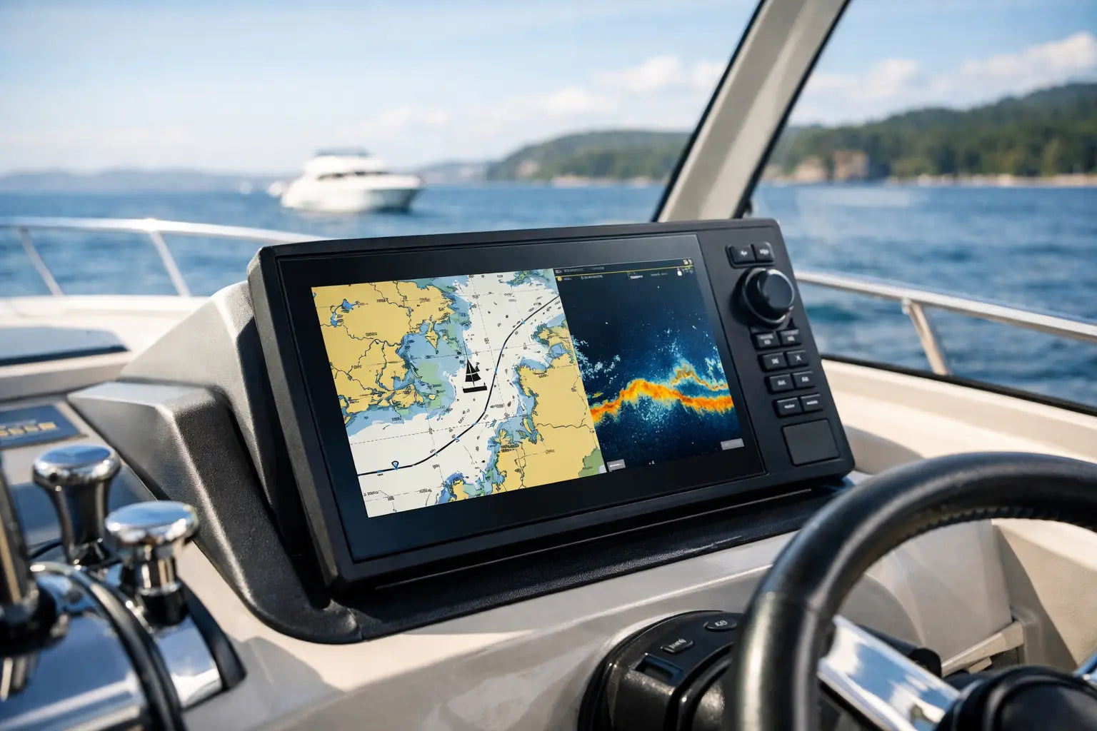

A chartplotter earns its place on the dash when the wind comes up, the shoreline disappears behind glare, and you need a clear answer to one question: where are you, and what is ahead? This marine gps chartplotter review focuses on the features that matter on real US waterways, from quiet freshwater coves to offshore runs and busy coastal channels.
The best unit is not always the biggest screen or the most expensive package. It is the one that fits your boat, your water, and the way you actually fish, cruise, tow, or travel. Buy for reliable navigation first, then add sonar, networking, and premium mapping features where they will make your days on the water better.
A marine GPS chartplotter combines satellite positioning with electronic charts, giving you a live view of your boat position, route, depth data, and nearby hazards. Most modern units can do far more than basic navigation, but those extra functions vary widely by model and package.
For a pontoon boat used on familiar lakes, a simple chartplotter with clear mapping and dependable GPS may be all you need. A bass boat owner may want detailed contour maps, side-scanning sonar, waypoint management, and trolling motor integration. Offshore anglers often benefit from a larger display, radar capability, AIS support, and backup navigation options.
Start with the water you run most often. Lakes, rivers, bays, the Intracoastal Waterway, and open ocean all put different demands on your electronics. A feature that looks impressive in a product comparison may not improve your next trip if it does not match your conditions.
Screen size is one of the most practical buying decisions. A compact 5- to 7-inch display can work well on a small aluminum fishing boat, kayak rig, or personal watercraft where helm space is limited. It is also a budget-friendly way to gain dependable GPS navigation and sonar.
For most center consoles, bay boats, pontoons, and larger fishing boats, a 7- to 9-inch display offers a more comfortable balance. You can see chart detail without constantly zooming, and split-screen views for charts and sonar remain usable. A 10-inch or larger screen makes sense for offshore boats, larger cabins, multi-station helms, or anglers who rely on multiple data views at once.
Do not judge a display by size alone. Brightness, anti-glare coating, viewing angle, touchscreen response, and button controls all affect day-to-day use. Touchscreens are fast for panning charts and setting routes, while physical keys can be easier to use with wet hands, gloves, or rough-water movement. Some units offer both, which is useful but can raise the price.
A chartplotter is only as useful as its mapping. Confirm which chart system comes included, what coverage it provides, and whether the unit accepts upgraded chart cards or downloads. Coastal boaters should look for current navigation aids, channel markers, tides, currents, and marina information. Inland anglers may place more value on high-resolution lake contours, shaded relief, and the ability to create or import routes and waypoints.
Pay attention to update access and cost. Some chart platforms include basic coverage with the unit but charge for premium detail or annual updates. That is not necessarily a bad deal, but it should be part of the total ownership cost. A lower-priced chartplotter can become less affordable if the mapping you need requires an expensive add-on.
Electronic charts support smart decisions, but they do not replace safe boating habits. Keep a paper chart or backup navigation method aboard for longer runs, know how to read markers, and stay alert for changing shoals, floating debris, and local restrictions.
If fishing is a major reason you are upgrading, sonar deserves as much attention as GPS. Basic 2D sonar shows depth and fish arches beneath the boat. It remains useful, affordable, and easy to interpret for many anglers.
Down-scanning sonar provides a more photo-like view of structure directly below, helping you identify brush piles, rock, wrecks, and hard bottom. Side-scanning sonar looks out to either side of the boat, making it valuable for locating cover and fish-holding structure in broad flats, creek channels, and shorelines.
The catch is that sonar performance depends heavily on the transducer and installation. A high-capability display paired with a poorly mounted transducer can deliver disappointing readings at speed. Before buying, verify whether a transducer is included, what frequencies it supports, and whether it fits your hull type. Transom mounts are common and practical, while through-hull and in-hull options may suit larger boats or more specialized setups.
For casual fishing, do not overbuy sonar modes you will never learn to use. For tournament-minded anglers and serious coastal fishermen, clearer imaging and better waypoint tools can save time and help turn searching into catching.
Network features can make a chartplotter the center of your boat’s electronics system. Depending on the unit, connectivity may allow you to share waypoints between displays, display engine data, control an autopilot, connect a radar dome, receive AIS vessel information, or integrate with a compatible trolling motor.
These upgrades are most valuable when they solve a real problem. AIS can add confidence in high-traffic coastal areas and during low-visibility runs. Radar is a serious asset for offshore travel and fog-prone conditions, but it is unnecessary for many weekend lake boats. Engine data can help you watch fuel burn, RPM, temperature, and other key information from one screen if your motor and network support it.
Built-in Wi-Fi and Bluetooth are convenient for software updates, phone notifications, route planning, and wireless accessories. Still, do not make wireless features your top priority over chart quality, screen visibility, and a reliable GPS receiver. A chartplotter should work when cellular service is weak or unavailable.
A good buying decision begins with an honest look at the helm. Measure the available mounting area, including clearance behind the dash for flush mounting and cable bends. Consider where the sun hits the screen, whether a cover is needed, and how easily you can reach controls while seated or standing.
Then build a budget around the complete setup, not just the display price. Include the transducer, chart upgrades, mounting hardware, wiring, fuses, adapters, and installation labor if needed. Many boaters find that moving up one screen size is worthwhile, while paying for advanced networking that they will never use is not.
Here is a practical way to narrow the field:
Even the right chartplotter can underperform if it is installed carelessly. Use marine-grade wiring, follow fuse recommendations, protect connections from corrosion, and route cables away from sources of electrical interference when possible. A dedicated power connection often helps prevent voltage drops and random shutdowns.
Transducer placement deserves extra time. It needs clean water flow and should avoid strakes, rivets, steps, prop wash, and other turbulence that can disrupt readings. If you expect accurate depth at cruising speed, test the installation before permanently sealing every cable route.
After installation, update the software, set your preferred units, load or verify charts, and learn the basic functions at the dock. Create a few practice waypoints, build a short route, adjust sonar sensitivity, and set shallow-water alarms appropriate for your boat. A little setup time before departure makes the unit far more useful when conditions get busy.
The strongest marine GPS chartplotter review does not end with one universal winner, because boating is not one universal activity. A lake angler, a weekend pontoon captain, and an offshore crew need different tools, even if all three want clear navigation and dependable performance.
Choose a chartplotter that makes you more prepared without crowding your helm or your budget. Gear up with the mapping, screen clarity, and sonar capability your trips demand, then spend time learning it before the next launch. The best route on the water is the one you can see clearly and run with confidence.